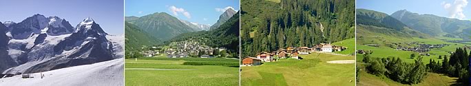
| Information about Switzerland |
 |
Switzerland Information |
|
|
|
 |
Country information |
|
| Atlas of Switzerland |
 |
Swiss atlases move into the third dimension
The "Atlas of Switzerland" and the "Hydrological Atlas of Switzerland" are now available in digital format with 3D visualisations. Their development represents a global innovation on the part of Swiss cartography. The new atlases allow users to combine various spatial data sources and visualise them in a clear, accessible way.
Representatives of the ETH Zurich (ETHZ), the Federal Office for the Environment (FOEN) and the Institute of Geography of the University of Bern (GIUB) presented the new "Atlas of Switzerland - online" and the new "Hydrological Atlas of Switzerland (HADES)" to the public today. Both atlases are the product of collaboration between the Swiss universities and the authorities.
Thanks to their three-dimensionality, the atlases can visualise a range of topics in a clear, accessible way, for example how built-up area has developed over the last century, how precipitation is distributed and where exactly water is scarce.
|
 |
The maps provide both experts and the general public with access to the various geodatabases compiled by the federal authorities and other data sources, for example from research.
Information technology innovation
The first new product, the "Atlas of Switzerland - online", provides a broad spectrum of users with direct and easy access to geographical information classified in ten thematic categories. The Atlas offers new visualisation options in 3D and interactive cartography. For example, it can be used to show that forests (together with lakes) are the biggest leisure infrastructure facilities in the Central Plateau. This can be observed when the forest area is combined with the leisure layer (hiking paths, Vitaparcours exercise trails, mountain-biking routes etc.). The Atlas, which is basedon a specially developed Atlas platform and vector data, represents another innovation by the Swiss universities in the field of geoinformation technology.
Hydrological Atlas HADES
The second atlas, the "Hydrological Atlas of Switzerland", HADES, is the product of collaboration between the GIUB, the FOEN and Swiss hydrologists. It is based on the same technology as the "Atlas of Switzerland". HADES has been providing summaries, maps and didactic media on the resource water for over 20 years with the support of the FOEN and numerous other institutions. Hence HADES deals with a key topic in the area of nature and the environment. Through its comprehensive edited data, it also provides in-depth information about hydrology and makes an important contribution to water management.
The two new atlases make Switzerland a world leader in the cartographic visualisation of spatial information. Access to the atlases is available free of charge to both experts and the general public.
nach
oben
| Neuer 3D-Atlas für Kartenliebhaber |
 |
Der «Atlas der Schweiz» ist erstmals seit dem 20. Juni 2016 online verfügbar und kostenlos nutzbar.
Seit der «Atlas der Schweiz» im Jahr 1965 erstmals in gedruckter Form erschienen ist, hat sich viel getan. Die Forschung hat Wissen kräftig vermehrt, die Statistik hat Datenberge angehäuft, der Mensch hat die Technik in allen Belangen vorwärtsgetrieben. Das merkt man auch dem «Atlas der Schweiz» an: Ab Frühsommer 2016 wird diese umfangreiche und mehrfach preisgekrönte Sammlung spezieller Themenkarten über die Schweiz erstmals kostenlos im Internet veröffentlicht. Die Zeit des Papiers oder der Silberscheiben ist damit auch für dieses Atlaswerk vorbei. Die Daten müssen dabei nicht auf dem eignen PC installiert werden, sondern können mit Hilfe einer App - einem Miniprogramm, das beim Anzeigen der Daten hilft - bequem abgerufen werden.
Der Online-Atlas bietet nach wie vor die bewährte Sammlung von Kartenthemen. Dazu gehört zum Beispiel das Thema Geologie in der Kategorie «Natur und Umwelt». Neu ist die Kategorie «Geschichte und Zukunft». Damit lassen sich beispielsweise Veränderungen der Besiedlung der Schweiz über die Zeit nachverfolgen.
Entwickelt wurde der «Atlas der Schweiz - online» am Institut für Kartografie und Geoinformation der ETH Zürich. Dabei arbeitete das Institut eng zusammen mit den Bundesämtern für Landestopografie, für Statistik und für Umwelt und rund 70 weiteren Institutionen.
Der Kartenserver ist übrigens kein anonymer Cloud-Dienst; sämtliche Daten des «Atlas der Schweiz - online» liegen auf einem Server-Cluster, der am Institut für Kartographie und Geoinformation der ETH Zürich steht.
Um den Atlas der Schweiz zu nutzen, ist eine App erforderlich. Sie ist gratis und kann von der Website www.atlasderschweiz.ch heruntergeladen werden.
 |
|
Externe
Links |
top
| Links |
|
|
|
External Links |
|