| Tour |
information |
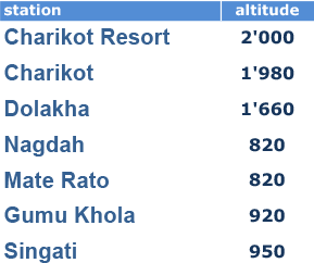
| Highest point |
Charikot , 2,000 m |
| Lowest point |
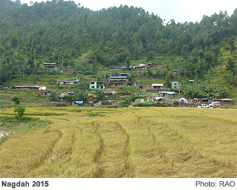
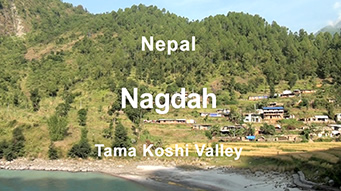
Nagdah, 820 m |
| Day 1 |
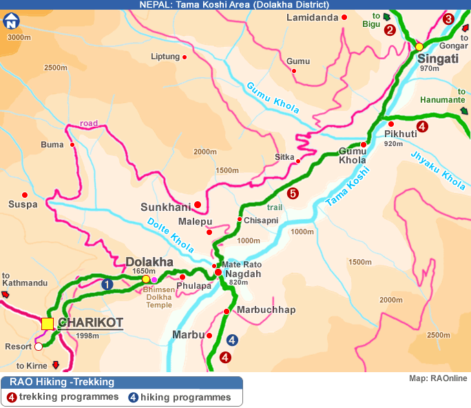
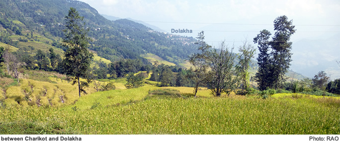
| Charikot - Dolakha- Nagdah |
| half a day trip |
| rest of the day: Explore the surroundings |
| Alternatives |
| Walk up to Marbu |
| take a river bath |
|
| Day 2 |
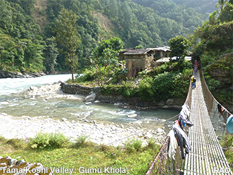
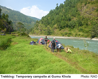
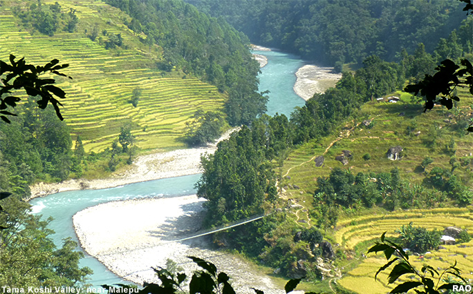
| Nagdah - Malepu - Gumu Khola |
| half a day trip |
| rest of the day: Explore the surroundings |
| Alternatives |
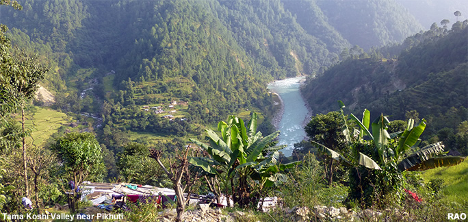
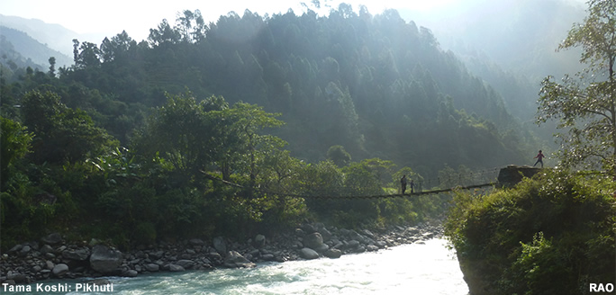
| Walk to Pikhuti and further in direction of Hanumante |
|
| Day 3 |
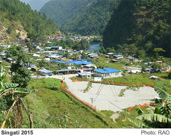
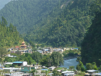
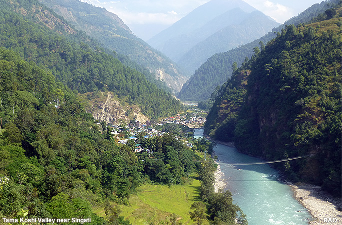
| Gumu Khola - Singati |
| a quarter of aday trip |
| rest of the day: Explore the surroundings |
| Alternatives |
| steep walk up to Bulung a.s.o. |
| Transport |
| Public bus or private taxi from Singati to Charikot (please ask the resort manager for transportation) |
|
| Yes! |
It is possible to walk from Charikot to Singati just in one day. But why so fast? There is a lot to see on both sides of the trail. Take time to speak with local people. |
|
| Specific
points |
to note |
| Bus
from Charikot |
be
in Singati before 4 pm |
| Temperature |
can
be hot even in April or November |
| Scenic
Views |
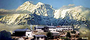
View
to Kalinchowk, Gauri Shankar at the beginning of the trek, amazing river valley views along the trek |
| Places
to see |
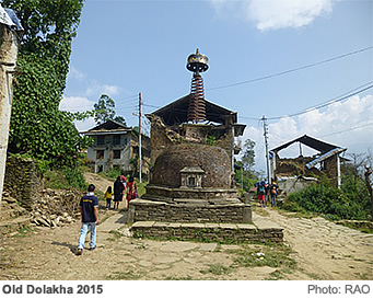
-
Old Dolakha
-
Dolakha: Bhimsen mandir
-
Malepu: Rural life |
| Places
to rest |
-
Nagdah: River front
-
Nayapul: River beach
-
Gumu Khola: River front
-
Singati north: River front |
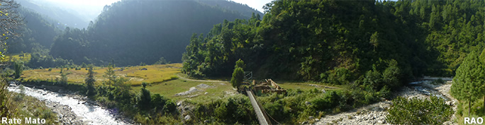
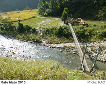
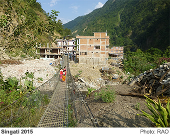
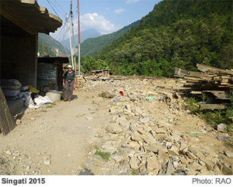
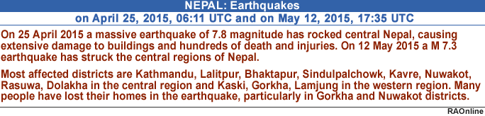
| Earthquake |
- Rate Mato: campsite not in operation
(2015-16)
- Rate Mato: shops destroyed
(2015-16)
- Tea shop at 1000m: destroyed (2015)
- Nagdah: Tea shop open for guests |
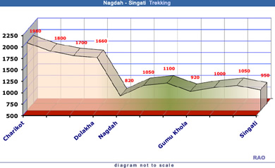
| The
climb down to Nagdah is an extremely steep one: allow for much more time
on your way back. |
|