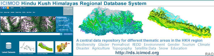
| Nepal's
Glaciers - Climate Change |
 |
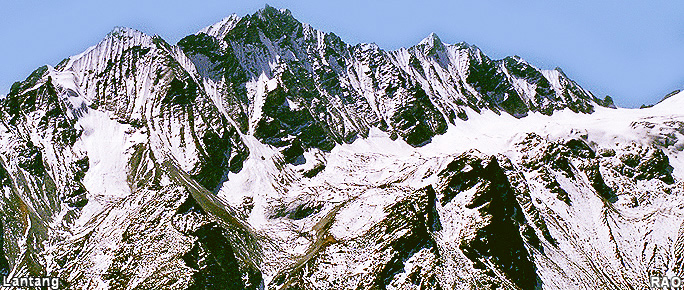
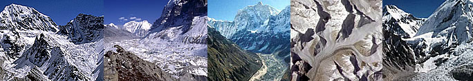
Nepal Himalayas Glaciers |
|
Nepal Information |
|
|
 |
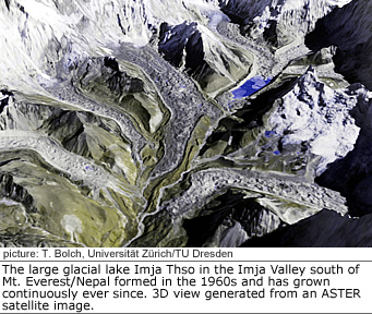
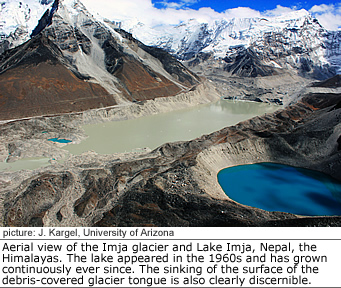
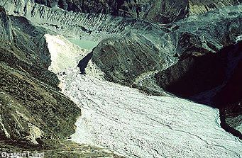
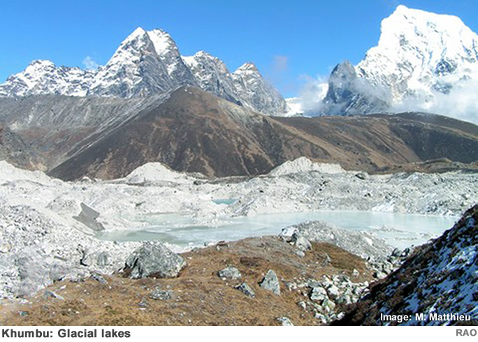
| Glacial Lakes Outburst Flood (GLOF) |
Himalayan
Mountain Lakes at High Risk of Bursting their Banks with Devastating Consequences
for People and Property.
 |
| Out burst of Sabai Tsho, Inkhu Valley, Khumbu (1998) |
|
Nearly 50 lakes, high in the Himalayas, could
burst their banks sending millions of gallons of deadly floodwaters swirling
down valleys, putting at risk tens of thousands of lives scientists
are warning. |
|
The lakes
are rapidly filling with icy water as rising temperatures in the region
accelerate the melting of glaciers and snowfields that feed them.
In
Nepal, for example, data from 49 monitoring stations reveals a clear increase
in temperature since the mid-1970s with highest temperatures found at higher
altitudes.
On
average, air temperatures here are one
degree C higher than in the 1970s rising by 0.06 degrees C per year.
It is not just people who are at risk but many millions of dollars worth
of property, tourism facilities, trekking trails, roads, bridges and hydro-electric
plants which are the economic life-blood of many countries in the region.
Scientists with the United Nations Environment Programme (UNEP) and the
International Centre for Integrated Mountain Development (ICIMOD) have
found at least 44 glacial lakes that are filling so rapidly they could
burst their banks in as little as five years' time.
 |
 |
|
 |
 |
|
 |
|
 |
Surendra
Shrestha, Regional Coordinator in Asia for UNEP's Division of Early Warning
and Assessment, said: "Our findings indicate that 20 glacial lakes in
Nepal and 24 in Bhutan have become potentially dangerous as a result of
climate change. We have evidence that anyone of these could, unless
urgent action is taken, burst its banks in five to 10 years time with potentially
catastrophic results for people and property hundreds of kilometres downstream.
These are the ones we know about. Who knows how many others, elsewhere
in the Himalayas and across the world, are in a similar critical state?"
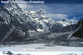
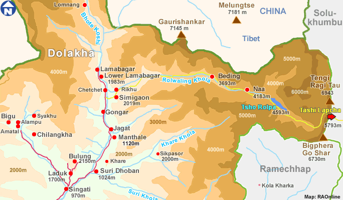
Pradeep
Mool, a remote sensing expert with ICIMOD, said work is underway to lower
the water levels of one critical glacial lake pinpointed by on the ground
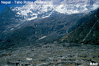
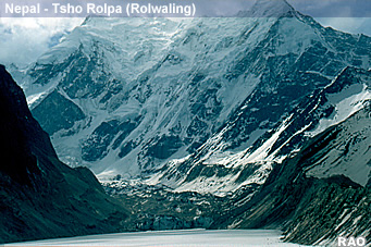
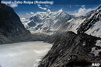
surveys and new satellite images. This is the Tsho Rolpa Lake that feeds
the Rolwaling and Tama Koshi valleys in the Dolakha District of Nepal.
The researchers have found that, as a result of the melting of a nearby
glacier, the lake has grown six-fold, from an area of 0.23 square kilometres
in the late
1950s to one of 1.4 square kilometres now. "A flood from this lake could cause
serious damage down to the village of Tribeni, which is 108km downstream,
threatening about 10,000 human lives, thousands of livestock, agricultural
land, bridges and other infrastructure, " said Mr Mool. A high tech communications
network of sensors and sirens has been linked from the lake to villages
at risk from floodwaters. Engineering work is underway to lower the water
levels at Tsho Rolpa by 30 metres.
Nevertheless,
experts say money is needed urgently to carry out similar work on scores
of other glacial lakes if catastrophes are to be averted. "Part of our
work is to help the governments of Nepal and Bhutan find and focus on potentially
dangerous lakes, develop early warning systems, be able to warn communities
of an impending Glacial Lake Outburst Flood (GLOF), and to carry
out engineering works to reduce the threats. Some donor country governments
are backing our efforts but much more aid is needed. Solving this problem
is going to be costly because glacial lakes are situated in remote areas
which are difficult to reach," said Mr Shrestha.
 |
 |
| Klaus
Toepfer, Executive Director of UNEP, said: "Mountains were once considered
indomitable, unchanging and impregnable. But we are learning that they
are as vulnerable as the world's oceans, grasslands and forests to environmental
threats and insensitive, unfettered, development. Climate change is the
biggest threat facing humankind with extreme weather events, droughts and
rises in disease forecast for many parts of the globe over the coming decades".
"The findings from our joint studies in the Himalayas, the roof of the
world, reveals the extent of a new, and alarming, threat. It is not just
the risk to human lives, agriculture and property that should worry us.
Mountains are the world's water towers feeding the rivers and lakes upon
which all life depends. If the glaciers continue to retreat at the rates
being seen in places like the Himalayas, then many rivers and freshwater
systems could run dry, threatening drinking water supplies as well as fisheries
and wildlife. We now have another compelling reason to act to reduce emissions
of carbon dioxide and other greenhouse gases," said Mr Toepfer. |
|
|
|
 |
|
|
 |
|
 |
Glacial
Lake Outburst Floods (GLOFs) are not a new phenomenon but there is evidence that the frequency of such
events has risen over the past three decades.
In
August 1985,
a sudden out burst flood from the Dig Tsho glacial lake in Nepal
destroyed 14 bridges and $1.5 million worth of damage was caused to the
nearly completed Namche Small Hydropower Plant. The new research began
in 1999 and is based on topographic maps, aerial photographs and satellite
images from Landsat, Spot and IRS craft. The
survey has identified 3,252 glaciers and 2,323 glacial lakes in Nepal and
677 glaciers and 2,674 glacial lakes in Bhutan. The researchers estimate
20 glacial lakes in Nepal and 24 in Bhutan are potentially dangerous.
For
example the Bhutan's Raphstreng Tsho glacial lake in the Pho Chu
River sub-basin measured 1.6 km long, 0.96 km wide and was 80 metres deep
in 1986.
The latest figures (1995)
show the lake has swollen to be 1.94 km long, 1.13 km wide and has a depth
of 107 metres. Its neighboring glacier could generate a GLOF up to two-and-a-half-times
that which caused major devastation in October 1994.
The 43 other glacial lakes, pin pointed in the survey and deemed to be
in a dangerous state, show similar patterns
The
filling of the lakes, and the threat of their mud and debris walls being
breached, is as a result of rising temperatures melting the glaciers. Satellite,
mapping and other surveys indicate that, for example,the glaciers in Bhutan are retreating at a rate of 30 to 40 metres a year.
In
some areas the retreat is even faster. The Tradkarding glacier,
which feeds the Tsho Rolpa glacial lake in Nepal's Rolwaling Valley,
is retreating at a rate of over 20 metres a year and, in some years within
the last decade, reached 100 metres per year.
The
UNEP Regional Resource Centre-Asia and the Pacific, the ICIMOD's Division
of Mountain Environment and Natural Resources' Information System, the
Department of Geology and Mines of the Royal Government of Bhutan and the
Department of Hydrology and Meteorology of His Majesty's Government of
Nepal carried out the research.
|
| Source: UNEP/ICIMOD 2002 |
top
|
more information
|
|
| Reports |
|
| Himalayas |
Snow, Ice, Glacier, Glacial Lakes and Floods Reports |
 |
| Links |
|
 |
|
External
link |
|