|
Nepal Trekkings |
|
|
|
| Ganesh Himal
Region Trekking: Tsum Valley |
|
|
About Tsum Valley
|
 |
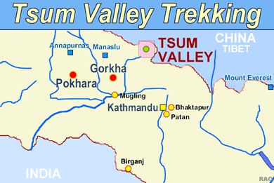
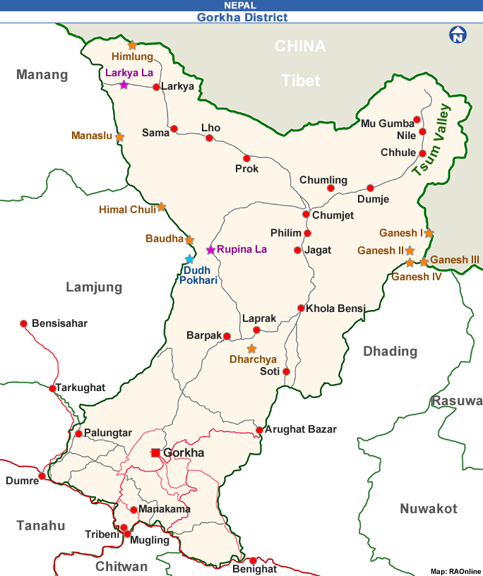
The valley is drained by the Shyar Khola, which originates from the western glacier of Ganesh Himal and east and southern glaciers of Sringi Himal and meets the Budhi Gandaki at Nyak. It is approachable via two routes: one passing through Chumchet and another from Lokpa (see Map of Tsum Valley).
Both routes involve steep ascents of over 1500m from the valley floor. The valley is uniquely rich in wildlife, especially in ghoral and tahr, which congregate in herds of 50 to 200. Hunting is not permitted in the Tsum Valley. The valley also boasts some unique and historic monasteries, including Rachen Gumba and Mu Gumba, which lie on a pretty plateau nestled in the lap of the valley, and Gumba Lungdang, situated at the base of a conical hill against the main slope of Ganesh Himal.

|
 |
|
GEOGRAPHY
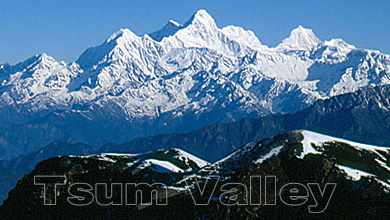
The Tsum Valley is ringed by the Baudha Himal and Himal Chuli to the west, Ganesh Himal to the south, and Sringi Himal to the north.
East of the valley, across the Shiar Khola, stands a dense blue, mixed pine forest, starting at Lokpa.
The valley is bounded by three high passes, the Ngula Dhojhyang (5093m) to the east, Thapla Pass (5104m) to the west, and Yamdro, also called the Humlung Pass, (5326m) to the north. The Valley is part of the extensive valleys of the Inner Himalaya.
It is popularly known as the 'Hidden Valley'. The pronounced aridity and broad open profiles of the valley, also called Bhot or elevated valley, is reminiscent of Tibetan landscapes.
The altitude of the Valley ranges from 1905m at Lokpa to over 5093m at Ngula Dhojhyang on the Tibetan border. It lies between latitudes 28° 20' 14.6" N and 28° 36' 47.7" N, and longitudes 84° 57' 18.8" E and 85° 11' 35.6" E. |
|
 |
CLIMATE
The Tsum Valley has four distinct climatic zones: sub-tropical (between 1000m and 2000m), cool temperate (between 2000m and 3000m), sub-alpine (between 3000m and 4000m), and alpine (above 4500m).
Temperatures vary widely between these zones. Winters are harsh (October to March); temperatures in the cool temperate, sub-alpine, and alpine regions drop below freezing and snowfall occurs for up to six months.
Below 3000m (sub-tropical and cool temperate regions), summers are comfortable with daytime temperatures between 22°C and 34°C. However, summer temperatures in the sub-alpine and alpine regions rarely go above 10°C.
The monsoon falls between June and September, the rest of the year being mostly dry. The average rainfall is around 1900mm per annum. The southern part of the valley is generally wetter than the upper valley.
Clear skies during October to December and April to June provide magnificent views of the surrounding mountains. |
| Source: International Centre for Integrated Mountain Development ICIMOD |
|
 |
|
 |
|
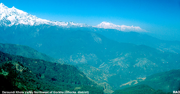 |
| Daraundi Khole Valley: possible access to Tsum Valley |
top
|
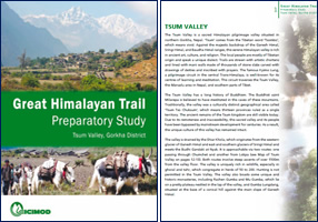
Tsum Valley Trekking Information - Brochure
|
 |
|
|
Links
|
|
 |
|
External
links |
 |
ICIMOD
International
Centre for Integrated Mountain Development
|

|
ICIMOD
|
top
| more information on Nepal |
|
|