|
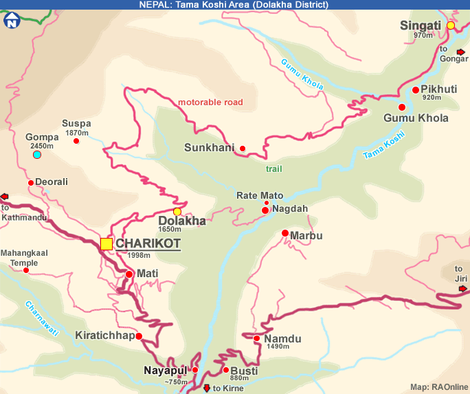
Charikot
- Deorali - Suspa - Dolakha - Charikot
|
 |
Charikot
and Dolakha |
|
|
 |
 |
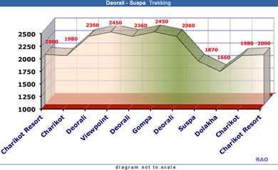
Charikot Hikking Routes |
|
Station |
Altitude
m
|
Distance
km |
|
1 |
Charikot
Resort |
2000
|
|
|
2 |
Charikot |
1980
|
1
|
|
3 |
Deorali |
2360
|
3
|
|
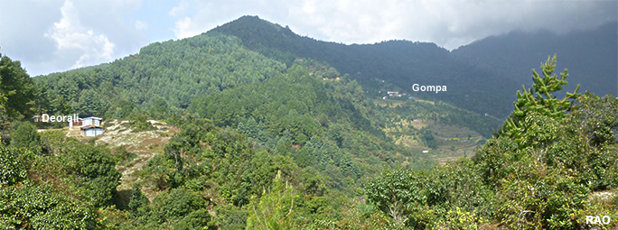
4 |
Viewpoint |
2450 |
1 |
| 5 |
Deorali |
2360 |
1 |
| 6 |
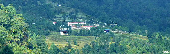
Gompa |
2450
|
2.5
|
| 7
|
Deorali |
2360 |
2.5 |
| 8 |
Suspa |
1870 |
2.5 |
| 9 |
Dolakha |
1660
|
3,5
|
| 10 |
Charikot |
1980
|
3
|
| 11
|
Charikot
Resort |
2000
|
1
|
|
Total |
|
21
|
|
Duration |
|
5-6
h
|
| Specific
points |
to note
|
| Bus
from Dolakha |
Be
in Dolakha before 4 pm |
| Alternative
route |
From
Deorali you can crossing two passes to reach Charikot. Ask for a guide. |
| Water |
Some
shops in Deorali, Suspa and Dolakha |
| Scenic
Views |
View
to Kalinchowk, Rolwaling Himal near the gompa
-
from viewpoint |
| Places
to see |
-
Old Dolakha
-
Gompa |
| Places
to rest |
-
Ridge before Deorali
-
Gompa
-
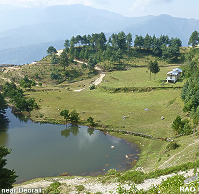
little lake east of Deorali
-
Dolkha or Dolakha
|
|
|
|
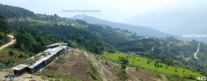
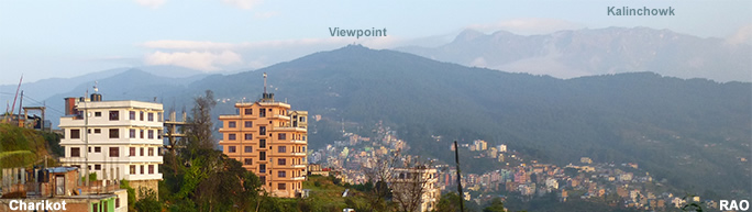
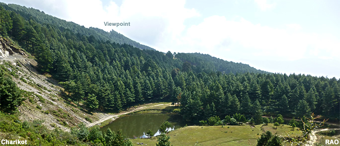
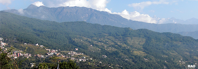
in
front: Charikot, trail to Deorali is leading on the lift side of the hill
covered with forest
in
the background: Kalinchowk Range (Kalinchowk is laying behind the second
range, visible as a snowy peak)
Trail:
The path is leading in a valley between the first and the second range
from left to right
|
| more
information |
 |
|