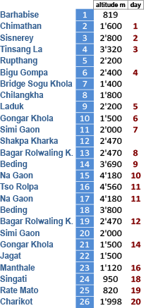
|
Charikot
and Dolakha - Trekkings |
|
|
 |
 |
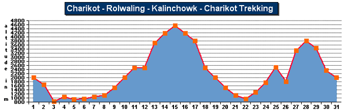
Charikot Trekking Route |
| Distance: |
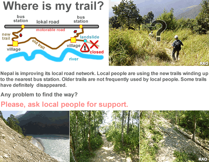
We have opted for approximate and 'comfortable'
walking
times rather than distances in miles, kilometres or 'kosh'. |
|
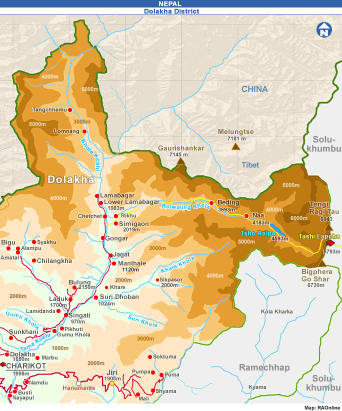
Charikot
- Rolwaling - Kalinchowk - Charikot |
|
|
| To
the start |
| Kathmandu
- Charikot (133 km, by bus or car) |
| Along
the Tama Koshi |
Charikot
- Dolakha (1 hour)
Spend
one or two hours here (see special section on Dolakha).
Dolakha
- Nagdah - Pikhuti - Singati (5-7 hours)
The
climb down to 5 Nagdah is an extremely steep one: allow for much more time
on your way back. After Nagdah, the trail leisurely follows the Tama Koshi
through pine forests. Stay ovemight at Pikhuti or push on to Singati (1 hour). |
| Entering
Rolwaling Valley |
Singati
- Simi Gaon (5-7 hours)
Cross
the bridge above Chhetchet which is beyond Gongar and loop
back to Simigaon on the other side of the river. |
|
|
| Rolwaling
Valley |
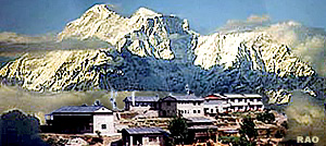
Simi
Gaon-Beding (4 - 5 hours)
Strictly
speaking this 4 days trek can easily be done in 3 days. However the walk
up the Tama Koshi and above the Rolwaling Khola is worth the extra time
spent. You can go on to Na, the last stop of any size before the Trashi
Labtsa (5,755 metres) which is the pass into the Khumbu region of Nepal.
However,we must stress that, unless you are a mountaineer (and even if
you are) the pass and the glacier on the other side are treecherous. It
certainly is not for the average trekker. Moreover, camping equipment and
food supplies are required for this route. One can return by the steep
route along the 'kharkas' or summer pastures to Simigaon and back the way
you came. This route is hard work. Some maps show a trail leading south
out of Rolwaling and over Baramje mountain back to Tama Koshi Valley or
to Jiri. This trail is no longer used nowadays and only some elderly village
people know about it. lt is snow-free only from July through September.
Unless you can master the Trashi Labtsa our advice therefore is to retum
to Charikot by the same route. Alternatively you could also branch oti
at Singati and climb up to Bigu and from there over Tinsang La (3319 m.)
down to Barhabise on the Amiko Highway. |
|
Between Nagdah and Pikhuti you will pass through Malepu. In the autumn,
waterfalls literally gush over the cliffs. A teashop under a jackfruit-tree
offers a welcome occasion for a stop. One can buy guava along this route.
Often to be seen are porters carrying huge slabs of slate from the mines
of Alampu, one of the biggest slate deposits in Nepal. Both the
mining and the portering of slate (we have met porters, with up to 70 kg
loads) are occupations which place extreme strains on human beings - another
dark side of poverty.
Along
the river you will also come across fishermen. Their nets are sometimes
made out of thread spun from the boiled and beaten bark of the Himalayan
nettle called 'Allo'. Try to buy your evening meal from them! The catfish
or trout-like fish has quite a few bones but its taste is delicious both
fresh and smoked.
As
you leave Simi Gaon you will walk above the Rolwaling Khola and pass
through some fine, dense forests on the way. This is why you will need
a guide, for it is easy to lose one's way. Rolwaling Valley is Sherpa country.
The staple food here is not rice but potatoes and 'dhiro' or boiled com
meal. In Singati you can buy some rice and take it along, for your
Sherpa hosts will love to share it with you in retum for a comfortable
place by the fire.
The
round-trip takes at least 10-12 days.
 |
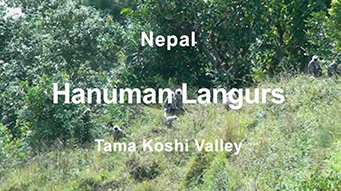
Tama Koshi Valley |
 |
|
more
information
|
 |
|