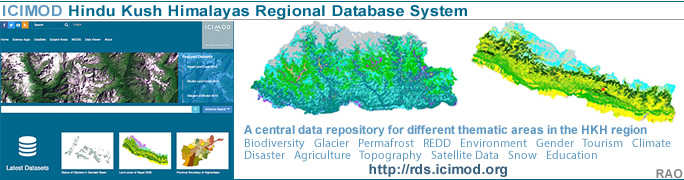
| Nepal's
Glaciers - Climate Change |
 |
Nepal Himalayas Glaciers |
|
Nepal Information |
|
|
 |
| Glacial Lakes Outburst Flood (GLOF) |
| Very little additional risk of glacial lake outburst from earthquakes in the Tama Koshi Basin |
 |
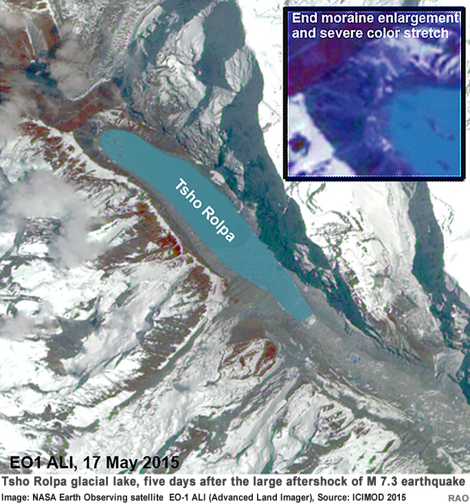
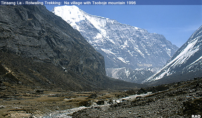
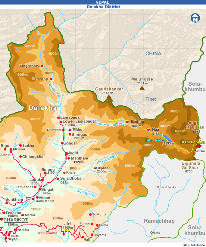
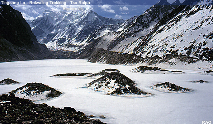
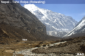
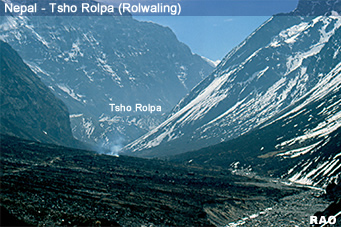
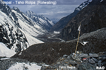
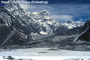
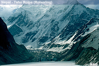
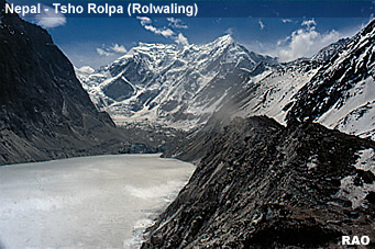
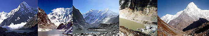
Much of Nepal and bordering areas of the Tibet Autonomous Region of China were heavily shaken by the moment magnitude 7.8 (7.6 ML, NSC) earthquake on 25 April 2015 and its aftershock of moment magnitude 7.3 (USGS; 6.8 ML, NSC). After the two major tremors, scientists and authorities in Nepal have been concerned about the structural integrity of one of Nepal's most dangerous glacial lakes, Tsho Rolpa, and the potential for a glacial lake outburst flood (GLOF) from it.
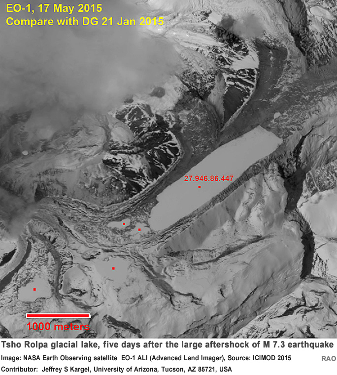
Study of the latest satellite images (from NASA Earth Observing satellite EO-1 ALI (Advanced Land Imager) taken on 17 May 2015 - five days after the large aftershock, the epicentre of which was nearby the lake - shows no definitive evidence that Tsho Rolpa's moraine or other parts of the glacier lake damming moraine system incurred damaged.
The 10 m (33 ft) resolution of the image does not permit detailed assessment of smaller structural features, but what can be seen does not elicit new concerns about the potential of a GLOF event. For example, no new drainage ways from Tsho Rolpa are visible, and no large landslides into the lake can be easily discerned. Discernible differences in pre- and post-earthquake images are primarily related to changes in seasonal snow cover.
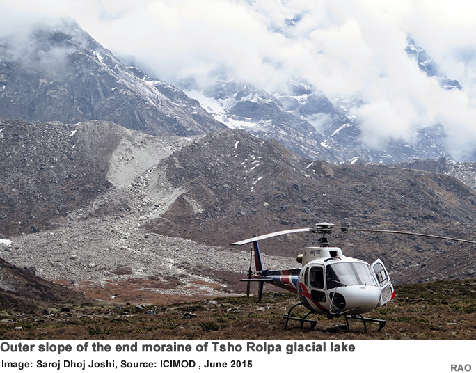
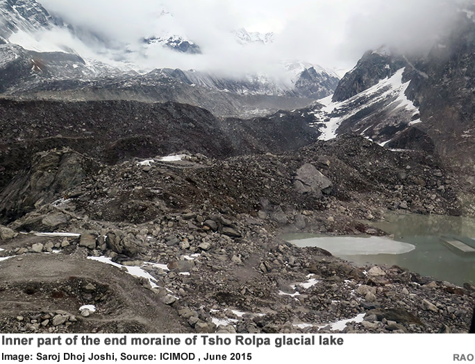
Photographs taken from a helicopter on 21 May 2015 and released by a Nepali newspaper (www.pahilopost.com/content/-4309.html) do not reveal disturbance to the moraine dam or to the engineered structures that have been used to lower and control the lake level.
The satellite images and aerial photos show that the lake itself is well-contained by the moraine dam. Additional aerial and ground-based photos were obtained by an independent concerned citizen, Saroj Dhoj Joshi, and were made available for this article. Joshi's photos show the hazardous nature of the moraines and adjacent mountain slopes, yet they also show no indication of recent disturbances caused by the earthquake. This work is an example of how satellite imagery, expert knowledge, and 'citizen science' can work together to assess public safety in the aftermath of a natural disaster.
There have been long-running concerns about the lake's safety. After concern peaked following the earthquake, authorities installed an automatic GLOF-warning system . (www.ekantipur.com/2015/05/21/national/early-warning-system-installed-in-tsho-rolpa/405485.html).
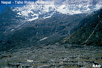
As described in the article, in the event of a GLOF, the system will sense an abnormal rise in stream flow and trigger warning messages to be sent to mobile phones, warning thousands of people in downstream villages.
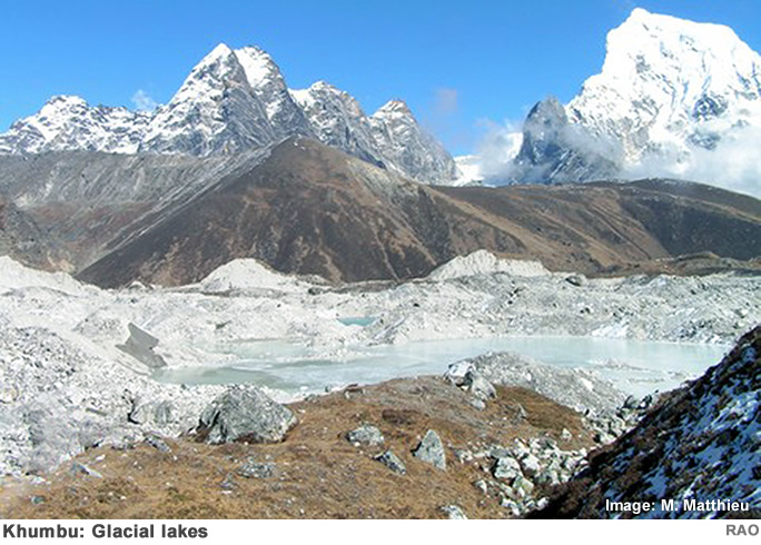
Many other glacial lakes in the Himalayas also seem untouched by the earthquake. With one minor exception in the vicinity of Imja Tsho, there is no evidence of glacial lake outburst floods, major damage to moraines, or large landslides in lakes across the Nepal-China border or others across the earthquake-affected region, nor has such an occurrence been reported by the media in China or Nepal.
The Chinese Academy of Sciences is tracking the effects of the earthquake in Tibet. Although the earthquake triggered many landslides, glacier lakes in the area appear to be unaffected, as our studies in Nepal have also shown. Although the observations to date are encouraging, detailed assessments using high resolution satellite imagery, aerial surveys, and ground-based observations are needed to confirm these preliminary conclusions. There are also lingering concerns about how the coming monsoon might affect small-scale fractures or other damage not visible in satellite images. Given this, continual monitoring in China and Nepal will be needed in the coming months.
Contributors: Jeffrey S Kargel, University of Arizona, Tucson, AZ 85721, USA, +1 520-780-7759, kargel@hwr.arizona.edu; Umesh Haritashya, University of Dayton, uharitashya1@udayton.edu; Saroj Dhoj Joshi, Real Time Solutions Pvt Ltd, Lalitpur, Nepal; Sharad Joshi, International Centre for Integrated Mountain Development (ICIMOD), Kathmandu, sharad.joshi@icimod.org; Narendra Raj Khanal, ICIMOD, Kathmandu, nrkhanal.geog@gmail.com; Gregory Leonard, University of Arizona, Tucson, AZ, gleonard@email.arizona.edu; Liu Shiyin, Cold and Arid Regions Environmental and Engineering Research Institute (CAREERI), Chinese Academy of Sciences (CAS), Lanzhou, China, liusy@lzb.ac.cn; Arun Shrestha, ICIMOD, Kathmandu, arun.shrestha@icimod.org; Dan Shugar, University of Victoria, dshugar@uvic.ca.
|
| Source: Text ICIMOD, June 2015 |
top
|
more information
|
|
| Snow, Ice, Glaciers, Glacial Lakes and Floods - Reports |
|
| Himalayas |
 |
Snow, Ice, Glacier, Glacial Lakes and Floods Reports |
 |
| Links |
|
 |
|
External
link |
 |
International
Centre for Integrated Mountain Development
ICIMOD |
|
 |
 |
| Tsho
Rolpa, Rolwaling Valley |
|