| Nepal's
Glaciers - Climate Change |
 |
Nepal Himalayas Glaciers |
|
Nepal Information |
|
|
 |
| Glacial Lakes Outburst Flood (GLOF) |
| Remote-sensing and field validation confirm expansion of Tsho Rolpa glacial lake |
 |
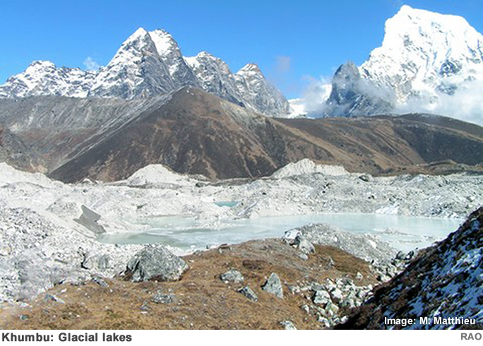
Why monitor glacial lakes?
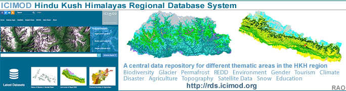
Of the 3,624 glacial lakes in the Koshi, Karnali, and Gandaki basins, our 2020 inventory (https://lib.icimod.org/record/34905) identifed 47 as potentially dangerous or at of risk of outburst flooding. In the Koshi basin alone, there are 42 potentially dangerous glacial lakes - 22 in China and 18 in Nepal.
The 26 recorded glacial lake outburst floods in Nepal have been devastating, claiming lives and destroying critical infrastructure such as roads and hydropower plants. Worryingly, these incidents are now increasing in frequency as the rise in global temperatures accelerates the melting of glaciers. Long-term, continuous monitoring of potentially dangerous glacial lakes is therefore critical. However, such lakes are often located in remote high mountains, not easily accessible for comprehensive !eld-based monitoring.
WeACT research on Tsho Rolpa glacial lake
Under the Web-Based Natural Dam-Burst Flood Hazard Assessment and ForeCasting SysTem (WeACT (https://gtr.ukri.org/projects? ref=NE%2FS005919%2F1)) project, a team from four institutions - ICIMOD, Loughborough University, Newcastle University, and Tribhuvan University - adopted a new approach for their study (https://www.isprs-annphotogramm-
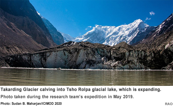
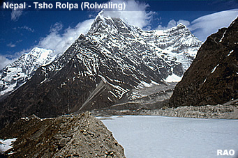
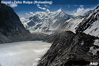
remote-sens-spatial-inf-sci.net/V-3-2020/633/2020/) that combines remote-sensing data with !eld validation to remotely monitor the expansion of Tsho Rolpa glacial lake, a potentially dangerous glacial lake in the Koshi basin. Data generated by remote sensing showed that the lake is expanding towards Takarding Glacier, and this was validated by an expedition team which observed the glacier ice calving into the lake. This new approach could be adopted to monitor lakes across basins.
Why Tsho Rolpa?
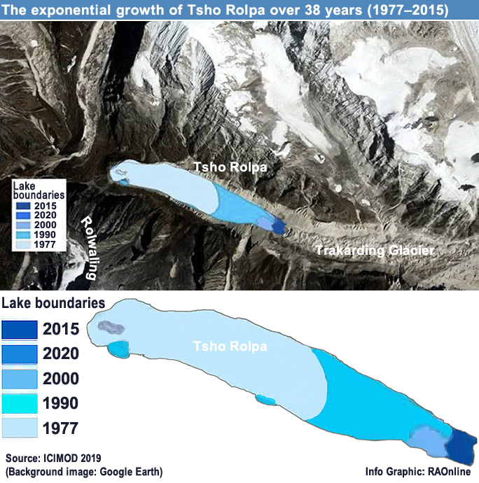
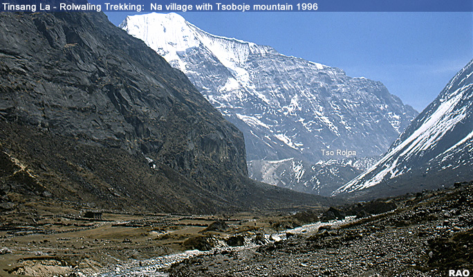
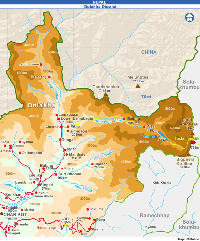
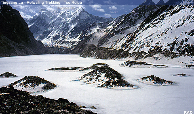
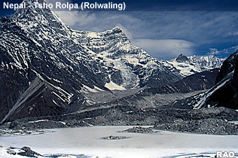
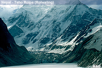
Tsho Rolpa glacial lake is located at 4,550 m asl in the Rolwaling Valley, Dolakha District, central Nepal. One of the advantages of studying Tsho Rolpa is the availability of data on the lake's evolution. Researchers began studying the lake in the early 1990s, when the lake's high flood risk was identi!ed. The lake's water level was lowered in the past to reduce the risk, but the lake is now expanding, and islands that were visible near the end moraine dam are shrinking. The WeACT research team observed continuous rock fall and landslides from the lake's side walls, ice in the lateral and end moraine melting, and glacier melt from the side valley feeding into the lake. All these developments add more stress to the lake's stability, and the risk of a moraine dam breach is potentially high.
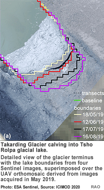
Remote sensing coupled with field-based validation
The WeACT research team used satellite images with a high spatial and temporal resolution to study Tsho Rolpa's boundary variations for the summer of 2019. The researchers used Copernicus Sentinel multispectral imagery to extract more accurate lake boundaries at a 10-m spatial resolution. Preliminary results estimated the lake's boundary changes and the glacier terminus horizontal position through time. The team validated the results through unmanned aerial vehicle-based photogrammetry, with information from the !eld-based ground control point using a di$erential global positioning system device. The team also compared their observations with previous estimations to !nd that the lake has been gradually expanding.
For Tsho Rolpa, the WeACT team's approach allowed the observation of monthly and annual boundary change rates beyond 2019 (starting from when the lake was !rst investigated in the early 1990s) using other data sources besides Sentinel imagery. This approach of using remote-sensing time series to monitor glacial lake evolution has the potential to improve glacial lake analysis in general. This research primarily enables stakeholders at the local, provincial, and national levels to understand changing GLOF risks and integrate the knowledge into their disaster management plans. �
|
| Source: Text ICIMOD, 24 December 2024 |
top
|
more information
|
|
| Snow, Ice, Glaciers, Glacial Lakes and Floods - Reports |
|
| Himalayas |
 |
Snow, Ice, Glacier, Glacial Lakes and Floods Reports |
 |
| Links |
|
 |
|
External
link |
 |
International
Centre for Integrated Mountain Development
ICIMOD |
|
 |
 |
| Tsho
Rolpa, Rolwaling Valley |
|