Nepal Trekkings
Trekkings in Nepal
Trekking Programmes
previous page
end Nepal Trekkings HOME
Nepal Trekkings
Trekking Information in Brief - in Kürze
Rating - Bewertung Photo Gallery
Kalinchowk Map - Karte
Trekkings: Programmes - Info
Trekking Areas
about the Himalayas
Trekking Information
Kalinchowk Trekking
Kalinchowk Trekking area Kalinchowk Trekking map
Area Kalinchowk map
Click on the map to get an enlarged picture.

top

Kalinchowk information
Gallery
Gallery
Earthquakes in Nepal
25 April 2015 M 7.8 Earthquake 12 May 2015 M 7.3 Earthquake
more information and pictures
Weather in Nepal Nepal Maps
Nepal Trekkings: Trekking Profiles
Trekking Programmes
Charikot - Dolakha
Tama Koshi Valley: Photo Galleries
Tama Koshi Hydroelectric Projects
Lamosangu-Jiri Road
Kalinchowk Trekking
Charikot - Singati - Gongar Road
Rolwaling Trekking
Nepal Kalinchowk - Khumbu
Glaciers in Nepal Photo Gallery
Himalayas & Tibet
Langtang - Gosainkund Everest Region
Bhutan Flight over the Himalayas
Nepal Himalayas: Air view
Tibetan Plateau and the Himalayas
Himalayas in Nepal: Mountain Peaks
Annapurna Region
Rolwaling - Khumbu
Informationen in deutscher Sprache Ökotourismusprojekt im Dolakha-Distrikt (Nepal)
new roads
Tama Koshi Valley
Charikot - Singati - Gongar Road
Lamosangu - Jiri Road
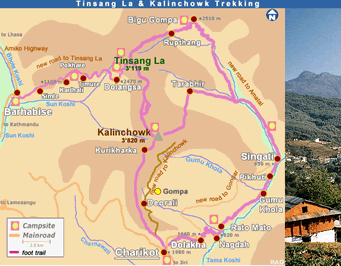
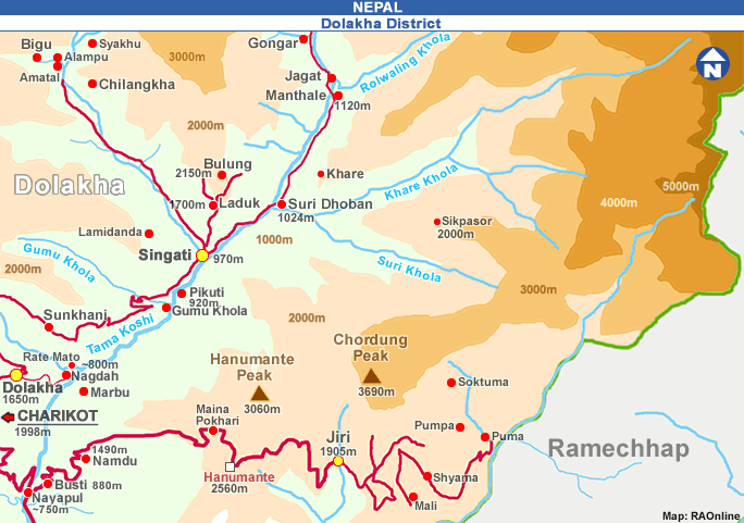
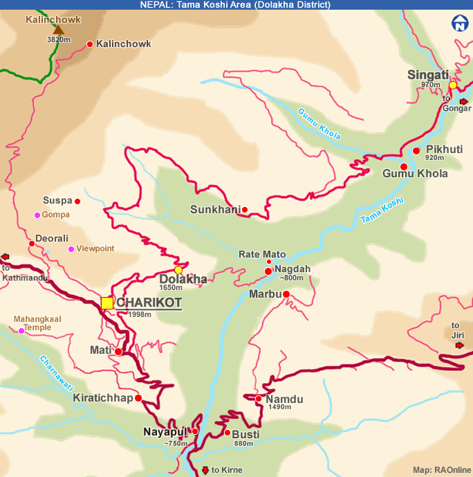
There is a motorable road from Charikot to Lamabagar (Tama Koshi valley). The Gongar - Lamabager section of the road is now completed. Lamabagar is accessible by 4WD vehicles. Feather roads are connecting Barhabise with Dolangsa (Tinsang La area) and Charikot with Deorali (Kalinchowk area).
Charikot - Dolakha District
Charikot - Dolakha
Nepal Trekking
Trekkings in Nepal
previous page Nepal Trekkings HOME