start
of trekking
Beginn |
Barhabise |
end
of trekking
Ende |
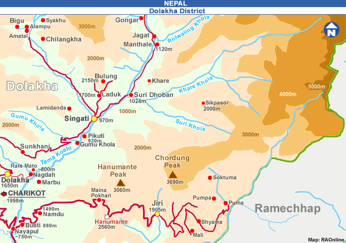
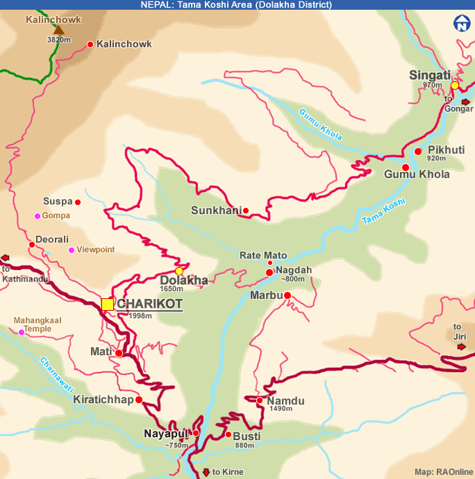
Charikot |
transports
Transporte |
bus
Kathmandu to Barhabise
bus
Charikot to Kathmandu |
lowest
point
tiefster Punkt |
Barhabise
820 m a.s. |
highest
point
höchster Punkt |
Kalinchowk
about 3750 m a.s. |
checkposts
Kontrollposten |
no |
lodging
Unterkünfte |
Bigu,
Singati, Dolkha, Charikot
and
more |
food
Nahrung |
available
in Barhabise, Bigu, Singati
and
in several shops bothsides of the trek |
camp
grounds
Zeltplätze |
Simle
Gaon, Dolangsa, Tinsang La, Bigu, Charikot, Singati and
more possibilities |
river
crossings
Flussüberquerungen |
by
suspension bridges |
mountain pass
Passübrgang
| Tinsang
La 3350 m a.s. |
places
of interest
Sehenswürdigkeiten
| Barhabise,
Charikot |
monasteries
Klöster |
Gompa
in Dolangsa
Gompa
in Bigu |
view
points
Aussichtspunkte |
Tinsang
La, Kalinchowk, Bigu, Charikot |
maps
Karten |
Lapchi
Kang
Scale
1:50,000
Nepal
- Kartenwerk der Arbeitsgemeinschaft für vergleichende Hochgebirgsforschung
Nr. 3
 |